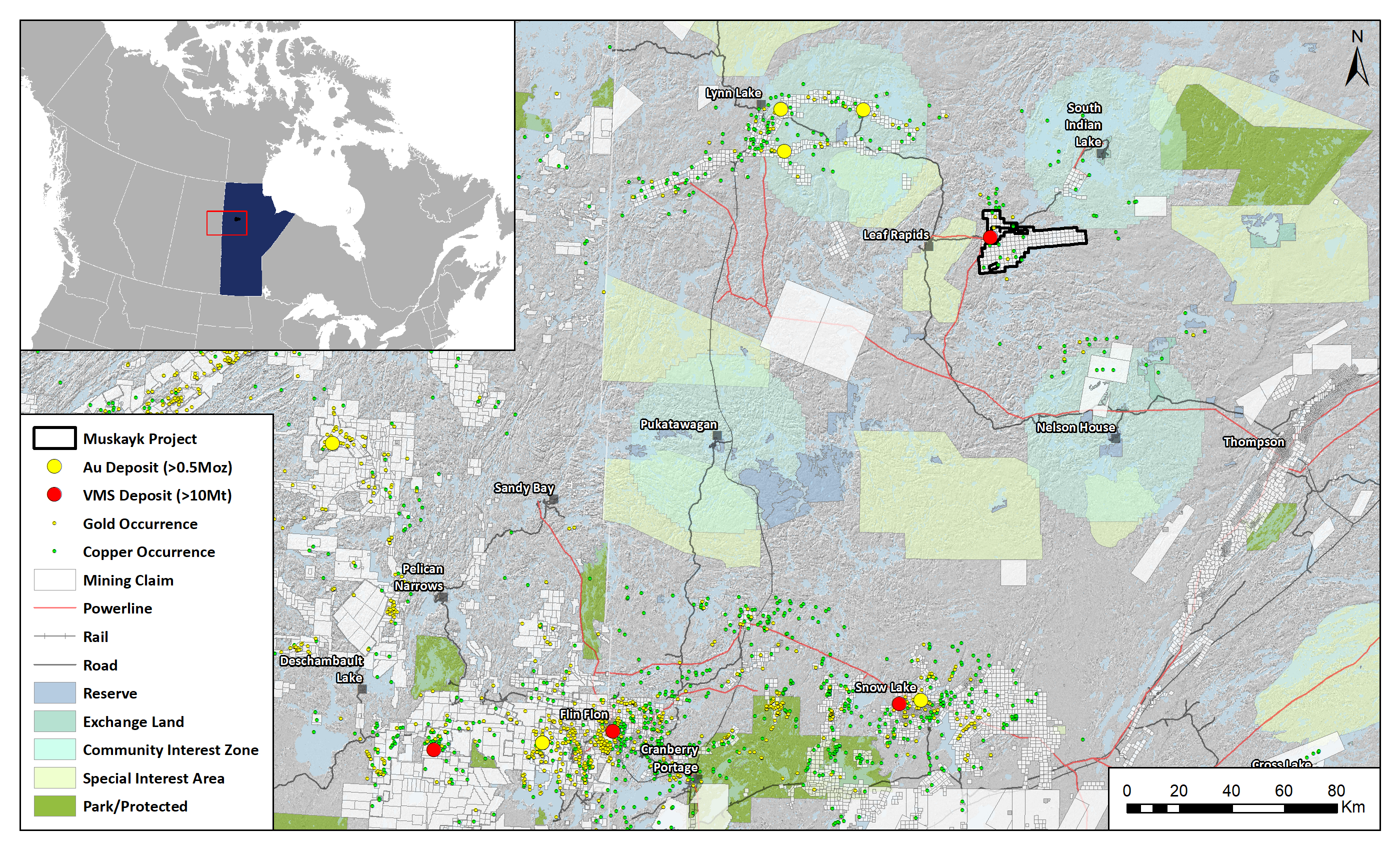
LOCATION
Manitoba, Canada
SIZE
39,633 ha
STAGE
Available
DEPOSIT TYPE(S)
Orogenic Au, Cu-Zn VMS
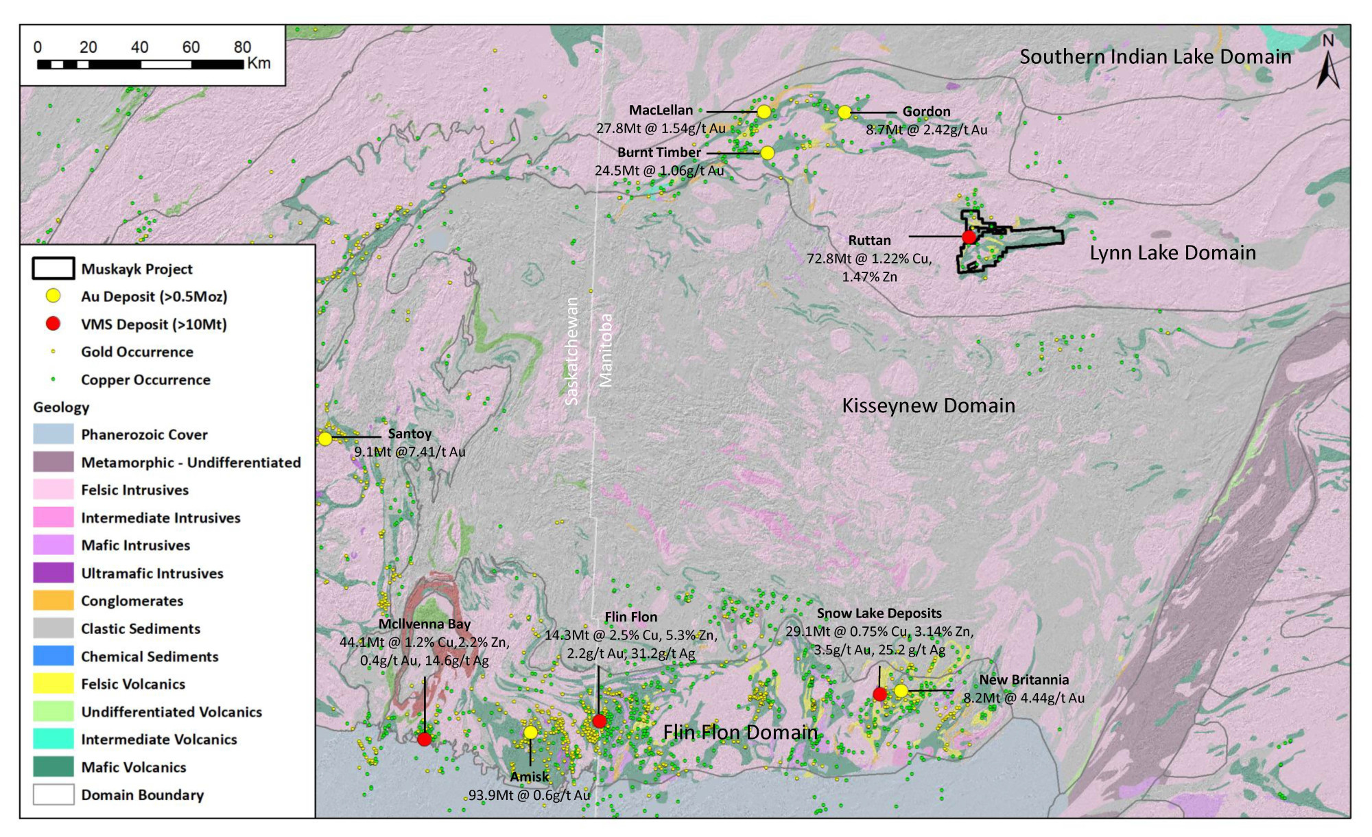
The Muskayk Project covers 39,633 hectares in the Paleoproterozoic Ruttan volcanic belt of northern Manitoba. The Project is adjacent to the past-producing Ruttan Cu-Zn massive volcanogenic sulphide (VMS) deposit and is transected by a major deformation zone. There are no systematic geochemical surveys on the Project and it represents underexplored potential for both orogenic Au and base metal VMS deposits.
Location and Access
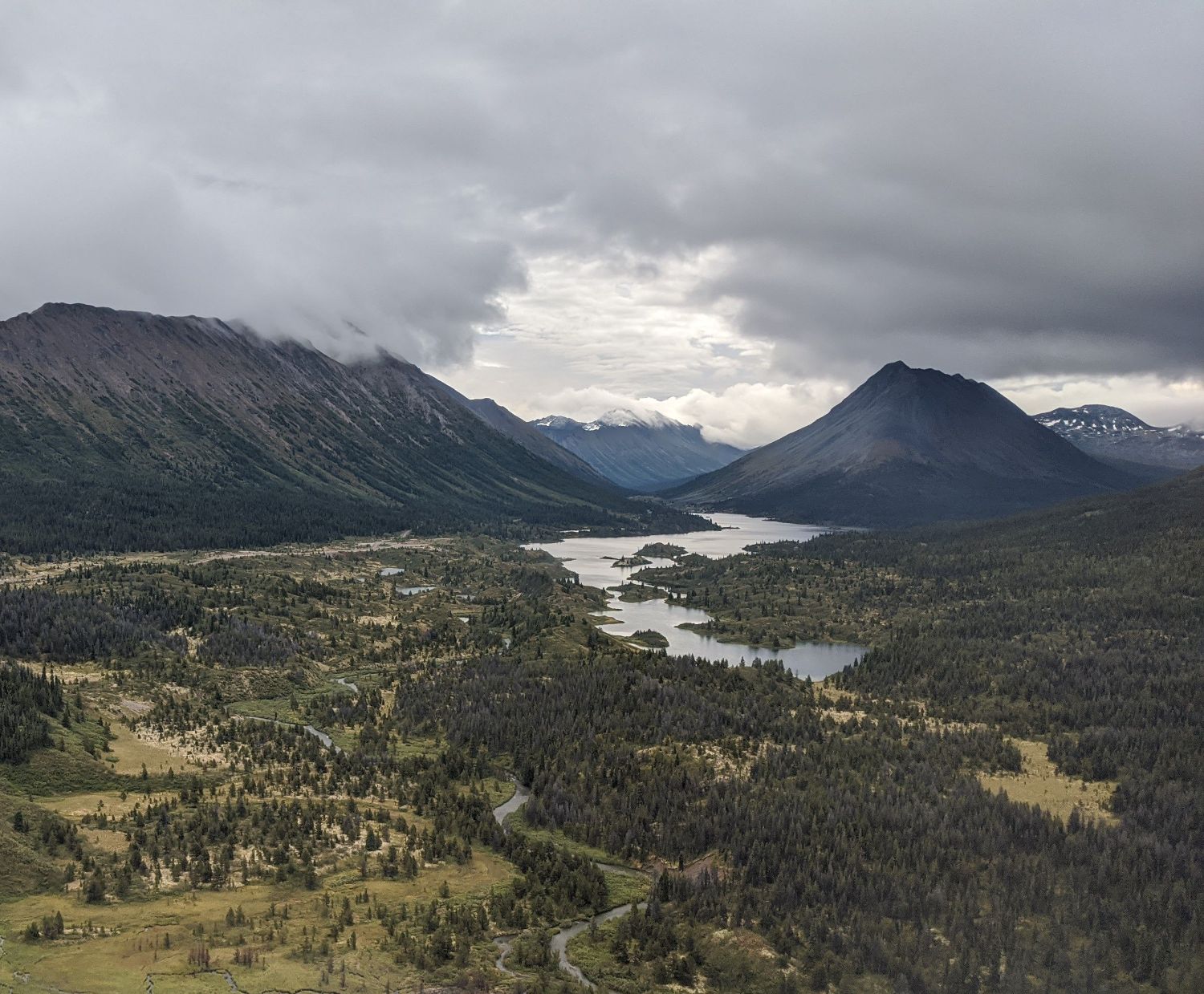
The Muskayk Project is approximately 20km west of the Village of Leaf Rapids in northern Manitoba. Favourable infrastructure exists in the area including both a gravel road and power transmission line crossing the eastern portion of the Project.
Geology and Mineralisation
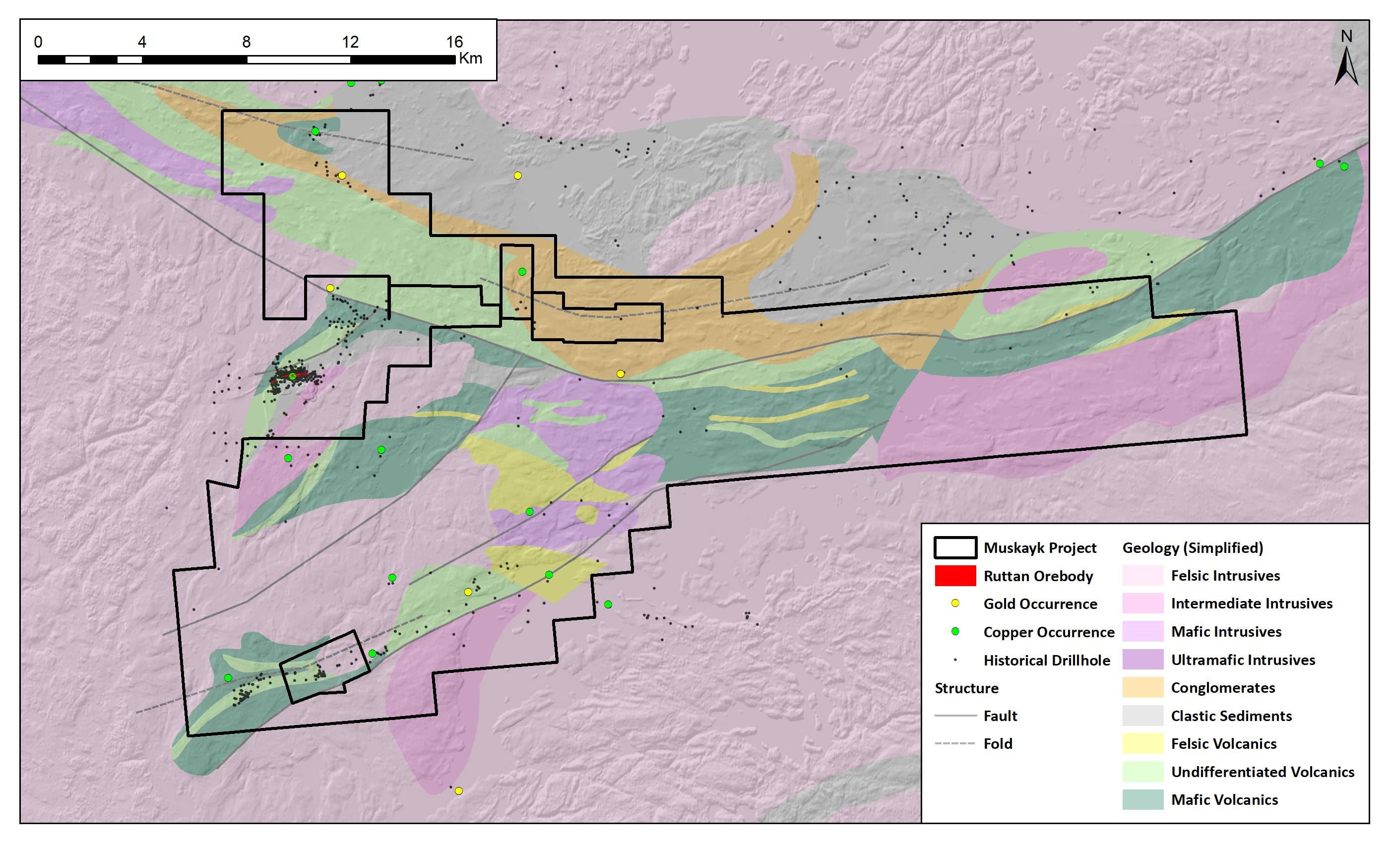
The Project encompasses the majority of the ca. 1878 Ma Rusty Lake greenstone belt in the Lynn Lake Domain of the Paleoproterozoic Trans-Hudson Orogen. The belt is dominated by a sequence of metamorphosed mafic and felsic volcanic rocks, volcanic derived sedimentary rocks and minor iron formations and bounded by paragneiss, orthogneiss and plutonic rocks of the Baldrock Batholith. The belt is broadly synformally folded and crosscut by a major east-west trending deformation zone (Vol fault), which divides the belt into a sediment-volcaniclastic dominated northern zone and a mafic-felsic bimodal dominated southern zone.
The Ruttan VMS deposit, adjacent to the Project, is a world class bimodal-siliciclastic Cu-Zn VMS deposit hosted in rhyolite tuffs and bounded by intermediate volcaniclastics and breccia. Orogenic style Au-Ag mineralisation occurs elsewhere in the Lynn Lake domain including the MacLellan deposit, hosted in mafic volcanic rocks cut by biotite-quartz altered sulphide bearing high strain zones mafic and the Gordon deposit, hosted in iron formation cut by sulphide and quartz vein bearing high strain zones.
Historical surface sampling and drilling have returned anomalous Au and Ag in sedimentary rocks along the major Vol fault in the north of the Project, and anomalous Cu and Zn associated with semi-massive sulphides in the southwest of the Project, along stratigraphy parallel to the Ruttan VMS deposit.
Historical surface sampling and drilling have returned anomalous Au and Ag in sedimentary rocks along the major Vol fault in the north of the Project, and anomalous Cu and Zn associated with semi-massive sulphides in the southwest of the Project, along stratigraphy parallel to the Ruttan VMS deposit.
Exploration History
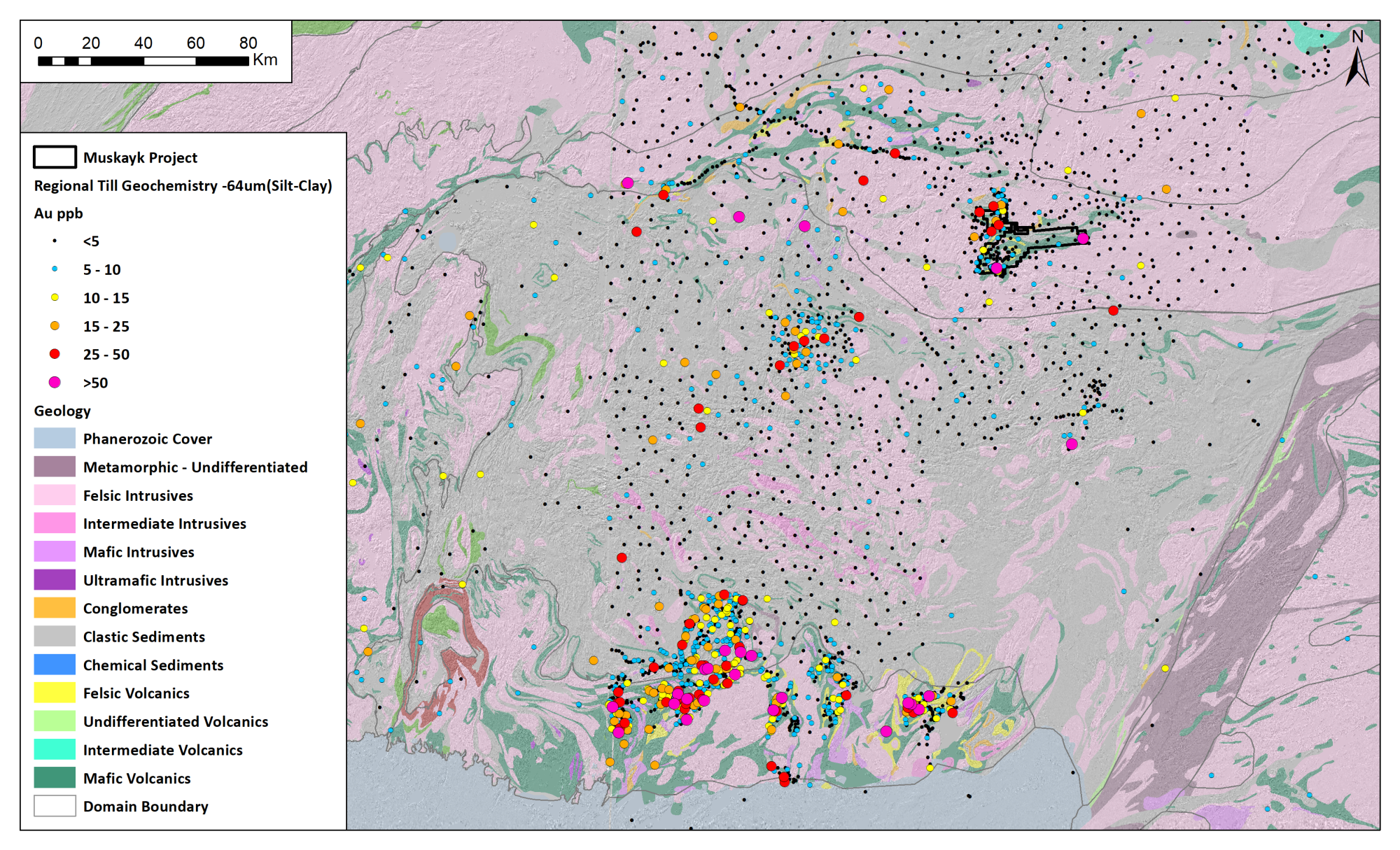
Historical exploration has primarily targeted VMS style mineralisation, with a focus on volcanic stratigraphy similar to the Ruttan deposit in the south-western portion of the Project area. A total of 164 historical drillholes have been completed within the Project boundaries. Airborne magnetic and electromagnetic (EM) geophysical surveys were flown on the eastern extents of the Project area, but limited ground geophysical surveys have been conducted. Little regional systematic geochemical exploration have been conduced on the property.
Summary of exploration activities conducted by Kenorland Minerals
Since staking the Muskayk Project, Kenorland minerals has undertaken compilation and digitization of historical drillhole logs and assay results, as well as compilation and reprocessing of historical airborne magnetic and EM conductivity surveys. In 2021, a fixed wing detailed LIDAR survey was completed by Kenorland, followed by surficial geological interpretation and ground-truthing to aid in the planning of systematic geochemical surveys.